haotu : an open lab notebook

2016/07/06

center gis point of a polygon shape file

Filed under: arcmap, R spatial — Tags: , — S @ 08:20

http://support.esri.com/technical-article/000009381

In the map document, open the attribute table for the polygon feature class by right-clicking the layer name.
In the attribute table, navigate to Table Options > Add Field and add two new fields of type Double. Name one ‘Longitude’ and the other ‘Latitude’.
Right-click the Longitude field and select Calculate Geometry.
In the Calculate Geometry dialog box, select ‘X Coordinate of Centroid’ from the Property drop-down menu. Click OK.
Right-click the Latitude field and select Calculate Geometry.
In the Calculate Geometry dialog box, select ‘Y Coordinate of Centroid’ from the Property drop-down menu. Click OK.

2016/02/03

add unique id to attributes table ArcMap 10.3.1

Filed under: arcmap, Python — Tags: , , , — S @ 08:39

This requires a bit of Python scripting, but it is simple. See here for the original post

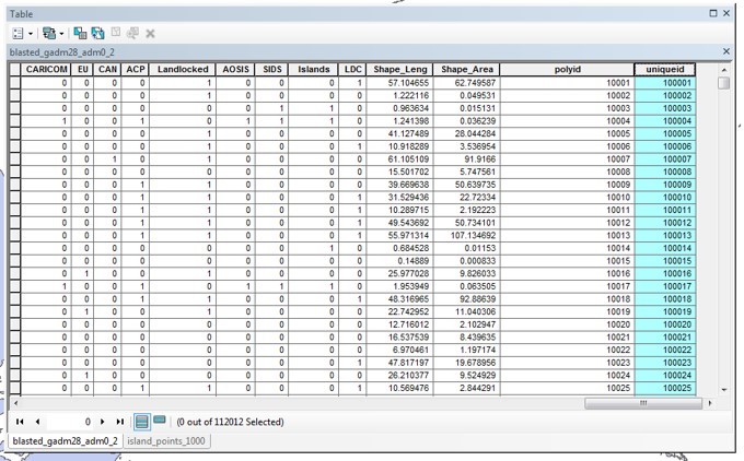
1. Add a numeric field (column) to attributes table (the column in blue is an example of what I want to produce):

uniqueid1

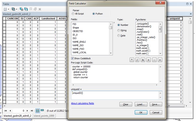
2. Right click on the new field and select field calculator.

uniqueid2

3. Make sure parser is Python and type is Numeric. In the code box put in:

counter = 100000
def uniqueID():
 global counter
 counter += 1
 return counter

and in the field = box make sure to give the function name

uniqueid()

in this example.

uniqueid3

4. Then it should produce a unique id for each element in the table. Note that you can change the starting number (1000000) and the increment number (1).

uniqueid4


Blog at WordPress.com.